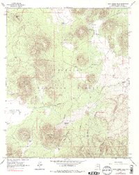
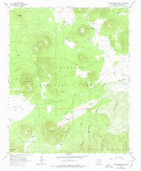
1966 Map of White Horse Hills
USGS Topo · Published 1978About this map
Coconino National Forest dominates this volcanic landscape, where the terrain rises from the relatively level Indian Flat and Kendrick Park toward the soaring heights of San Francisco Mountain. The northern reaches of the peaks are defined by deep drainage systems including White Horse Canyon, Reese Canyon, and Aubineau Canyon. Land use in this high-altitude environment is centered on resource management and fire suppression, evidenced by a Lookout Tower atop Saddle Mtn and a remote Landing Strip near the western margin.
Find a feature on this map
77 named features on this map. Tap any name to fly to it.
Don’t see what you’re looking for? This feature index may not catch every label — zoom into the map to look around manually.
Map Details
Editions of this 1966 White Horse Hills Map
5 editions found
Other maps of this area

1886 · San Francisco Mtns
USGS Topo · 1:250,000

1891 · San Francisco Mtns
USGS Topo · 1:250,000

1894 · San Francisco Mtns
USGS Topo · 1:250,000

1899 · San Francisco Mtns
USGS Topo · 1:250,000

1908 · Flagstaff
USGS Topo · 1:125,000

1912 · Flagstaff
USGS Topo · 1:125,000

1947 · Flagstaff
USGS Topo · 1:250,000

1954 · Flagstaff
USGS Topo · 1:250,000

1958 · Flagstaff
USGS Topo · 1:250,000

1960 · Flagstaff
USGS Topo · 1:250,000