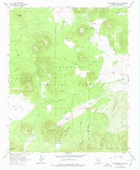
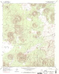
1966 Map of White Horse Hills
USGS Topo · Published 1978About this map
The White Horse Hills rise above the high-altitude landscape of northern Arizona, dominated by the sprawling reaches of the Coconino National Forest. This 1966 field-checked survey reveals a terrain defined by volcanic features and high-desert hydrology, where numerous livestock tanks like Bonita Tank and Potato Tank provide critical water sources. The landscape is carved by dramatic drainages including Deadman Canyon and Aubineau Canyon, which descend from the northern slopes of San Francisco Mountain.
Find a feature on this map
37 named features on this map. Tap any name to fly to it.
Don’t see what you’re looking for? This feature index may not catch every label — zoom into the map to look around manually.
Map Details
Editions of this 1966 White Horse Hills Map
5 editions found
Other maps of this area

1886 · San Francisco Mtns
USGS Topo · 1:250,000

1891 · San Francisco Mtns
USGS Topo · 1:250,000

1894 · San Francisco Mtns
USGS Topo · 1:250,000

1899 · San Francisco Mtns
USGS Topo · 1:250,000

1908 · Flagstaff
USGS Topo · 1:125,000

1912 · Flagstaff
USGS Topo · 1:125,000

1947 · Flagstaff
USGS Topo · 1:250,000

1954 · Flagstaff
USGS Topo · 1:250,000

1958 · Flagstaff
USGS Topo · 1:250,000

1960 · Flagstaff
USGS Topo · 1:250,000