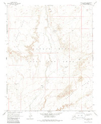
1967 Map of Sand Springs
USGS Topo · Published 1985About this map
The Moenkopi Plateau dominates this high-desert landscape within the Navajo - Hopi Joint Use Area during the late 1960s. This survey illustrates a complex administrative geography, defined by the Navajo-Hopi Joint Use Area Boundary and the Hopi Indian Res. Settlement is sparse, anchored by Sand Springs and scattered water sources critical for life in this arid environment, such as Whisky Spring, Drag Spring, and the Sand Valley Well. Drainage patterns like Dinnebito Wash and Saltwater Wash carve through the terrain, while the southeastern corner is marked by the distinct rises of the Garces Mesas and shifting Sand Dunes. The map provides a look at the infrastructure of the reservation before significant modern developments, focusing on the natural topography and essential water points.
Find a feature on this map
14 named features on this map. Tap any name to fly to it.
Don’t see what you’re looking for? This feature index may not catch every label — zoom into the map to look around manually.
Map Details
Editions of this 1967 Sand Springs Map
2 editions found
Other maps of this area

1883 · Tusayan
USGS Topo · 1:250,000

1886 · Tusayan
USGS Topo · 1:250,000

1886 · San Francisco Mtns
USGS Topo · 1:250,000

1891 · San Francisco Mtns
USGS Topo · 1:250,000

1894 · San Francisco Mtns
USGS Topo · 1:250,000

1899 · San Francisco Mtns
USGS Topo · 1:250,000

1947 · Flagstaff
USGS Topo · 1:250,000

1954 · Flagstaff
USGS Topo · 1:250,000
1955 · Black Falls 4 SE
USGS Topo · 1:24,000

1958 · Flagstaff
USGS Topo · 1:250,000