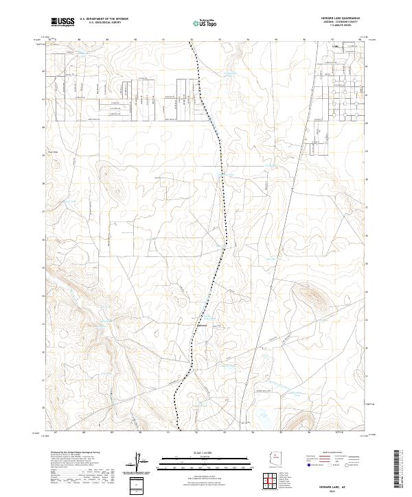
2021 Map of Howard Lake
USGS Topo · Published 2021About this map
Valle and the small settlement of Quivero anchor this high-desert landscape in Coconino County, characterized by a complex network of seasonal water management. The terrain is defined by the Spring Valley Wash and Red Lake Wash, which cut through the arid plains toward landmarks like Four Hills. This survey reveals an extensive system of catchment tanks essential for ranching and survival in this environment, including Railroad Tank, Red Hill Tank, and La Mesa Tank. The northern reaches show a developing street grid with names like E Rutgers Ave and E Newcastle Dr, contrasting with the more traditional rural loops such as the Howard Mesa Loop. This distribution of water features and local roads provides a clear picture of how modern land use and transportation corridors, such as Jackrabbit Dr, overlay the natural drainages of the Arizona plateau.
Find a feature on this map
44 named features on this map. Tap any name to fly to it.
Don’t see what you’re looking for? This feature index may not catch every label — zoom into the map to look around manually.
Map Details
Editions of this 2021 Howard Lake Map
This is the sole edition of this map. No revisions or reprints were ever made.
Other maps of this area

1886 · Chino
USGS Topo · 1:250,000

1891 · Chino
USGS Topo · 1:250,000

1922 · Williams
USGS Topo · 1:125,000

1948 · Williams
USGS Topo · 1:250,000

1954 · Williams
USGS Topo · 1:250,000

1956 · Williams
USGS Topo · 1:250,000

1960 · Williams
USGS Topo · 1:250,000
1960 · Williams
USGS Topo · 1:62,500

1961 · Williams
USGS Topo · 1:250,000

1962 · Valle
USGS Topo · 1:62,500