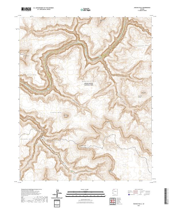
2021 Map of Havasu Falls
USGS Topo · Published 2021About this map
The Grand Canyon National Park landscape in 2021 is defined by the dramatic descent of Havasu Creek as it carves through the red rock toward the Colorado River. This map details the iconic series of cataracts including Havasu Falls, Mooney Falls, and Navajo Falls, which are accessible via the Havasu Canyon Trl. The sheer verticality of the region is evident in the towering heights of Mt Sinyella and Mt Akaba, which overlook expansive plateaus like Sinyella Mesa and Yumtheska Mesa. Evidence of the area's complex drainage is visible in the winding routes of Matkatamiba Canyon and Carbonate Canyon. Along the river corridor, navigators encounter the turbulent waters of Upset Rapids and Matkatamiba Rapids, while the Colorado River Trl provides a terrestrial path along the canyon's inner corridor.
Find a feature on this map
37 named features on this map. Tap any name to fly to it.
Don’t see what you’re looking for? This feature index may not catch every label — zoom into the map to look around manually.
Map Details
Editions of this 2021 Havasu Falls Map
This is the sole edition of this map. No revisions or reprints were ever made.
Other maps of this area

1886 · Kaibab
USGS Topo · 1:250,000

1953 · Grand Canyon
USGS Topo · 1:250,000

1957 · Grand Canyon
USGS Topo · 1:250,000

1958 · Grand Canyon
USGS Topo · 1:250,000

1960 · Grand Canyon
USGS Topo · 1:250,000

1962 · Kanab Point
USGS Topo · 1:62,500

1962 · Tuckup Canyon
USGS Topo · 1:62,500

1962 · Supai
USGS Topo · 1:62,500

1962 · National Canyon
USGS Topo · 1:62,500

1984 · Grand Canyon
USGS Topo · 1:100,000