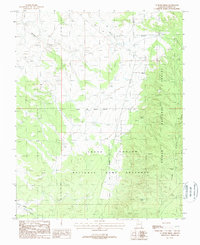
1988 Map of Le Fevre Ridge
USGS Topo · Published 1988About this map
Kaibab National Forest dominates this high-plateau landscape in northern Arizona, where the terrain is defined by the steep-walled Wildcat Canyon and the prominent Le Fevre Ridge. The map highlights the extensive boundaries of the Grand Canyon National Game Preserve, demonstrating the 1980s-era management of this protected wilderness area. Surveying precision is noted by the passage of the Gila and Salt River Meridian, which bisects the western half of the quadrangle. Occasional water sources like Hidden Lake and distinct topographical depressions such as Cutler Pockets provide essential landmarks in an otherwise dry environment. The presence of a Gravel Pit near the northern border and a network of primitive roads indicate the limited but necessary human footprint for forest maintenance and local resource extraction.
Find a feature on this map
12 named features on this map. Tap any name to fly to it.
Don’t see what you’re looking for? This feature index may not catch every label — zoom into the map to look around manually.
Map Details
Editions of this 1988 Le Fevre Ridge Map
This is the sole edition of this map. No revisions or reprints were ever made.
Other maps of this area

1886 · Kaibab
USGS Topo · 1:250,000

1936 · Jacobs Lake
USGS Topo · 1:48,000

1940 · Jacob Lake
USGS Topo · 1:62,500

1953 · Jacobs Lake
USGS Topo · 1:62,500

1953 · Grand Canyon
USGS Topo · 1:250,000

1954 · Shinarump NW
USGS Topo · 1:24,000

1957 · Grand Canyon
USGS Topo · 1:250,000
1957 · Shinarump NE
USGS Topo · 1:24,000
1957 · House Rock Spring NW
USGS Topo · 1:24,000

1957 · Shinarump SE
USGS Topo · 1:24,000