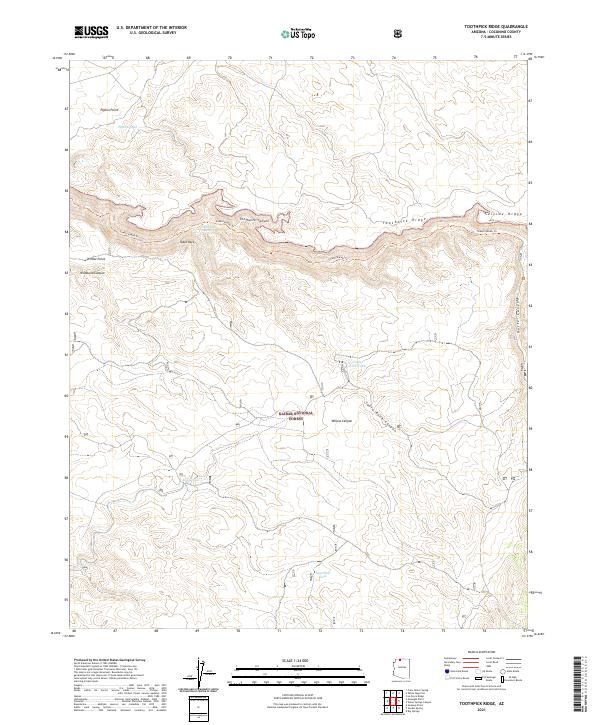
2021 Map of Toothpick Ridge
USGS Topo · Published 2021About this map
Kaibab National Forest dominates this landscape, where high-desert plateaus are carved by deep drainages like Toothpick Canyon and Wildband Canyon. The topography is defined by prominent escarpments such as Toothpick Ridge and the aptly named Suicide Ridge, which frame the central portion of the survey. The reliance on scarce water sources in this arid environment is evident in the naming of critical landmarks like Table Rock Spring and various man-made catchments, including Pigeon Tank and East Slide Tank.
Find a feature on this map
23 named features on this map. Tap any name to fly to it.
Don’t see what you’re looking for? This feature index may not catch every label — zoom into the map to look around manually.
Map Details
Editions of this 2021 Toothpick Ridge Map
This is the sole edition of this map. No revisions or reprints were ever made.
Other maps of this area

1886 · Kaibab
USGS Topo · 1:250,000

1953 · Grand Canyon
USGS Topo · 1:250,000

1954 · Fredonia
USGS Topo · 1:62,500

1957 · Grand Canyon
USGS Topo · 1:250,000

1957 · Shinarump SE
USGS Topo · 1:24,000

1957 · Shinarump SW
USGS Topo · 1:24,000
1957 · Shinarump
USGS Topo · 1:62,500

1957 · Jumpup Canyon
USGS Topo · 1:62,500

1958 · Grand Canyon
USGS Topo · 1:250,000

1958 · Big Springs
USGS Topo · 1:62,500