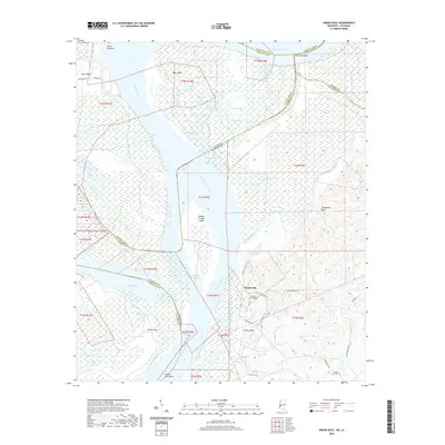
2020 Map of Grand Gulf
USGS Topo · Published 2020About this map
Grand Gulf sits at a strategic bend where the Mississippi River meets the mouth of the Big Black River, marking a landscape defined by centuries of hydrological change. The shifting course of the great river is visible in the complex network of oxbows and secondary channels, including Yucatan Lake, Dishroon Lake, and Old River Lake. These water bodies, along with the Yucatan Cutoff and Yucatan Ditch, illustrate the constant engineering and natural evolution required to manage navigation in this volatile floodplain.
Find a feature on this map
52 named features on this map. Tap any name to fly to it.
Don’t see what you’re looking for? This feature index may not catch every label — zoom into the map to look around manually.
Map Details
Editions of this 2020 Grand Gulf Map
This is the sole edition of this map. No revisions or reprints were ever made.
Other maps of this area

1909 · Lake Bruen
USGS Topo · 1:24,000

1939 · Yokena
USGS Topo · 1:62,500

1939 · Lorman
USGS Topo · 1:62,500

1953 · Natchez
USGS Topo · 1:250,000

1955 · Jackson
USGS Topo · 1:250,000

1956 · Natchez
USGS Topo · 1:250,000

1958 · St. Joseph
USGS Topo · 1:62,500

1959 · Natchez
USGS Topo · 1:250,000

1961 · Jackson
USGS Topo · 1:250,000

1962 · Jackson
USGS Topo · 1:250,000