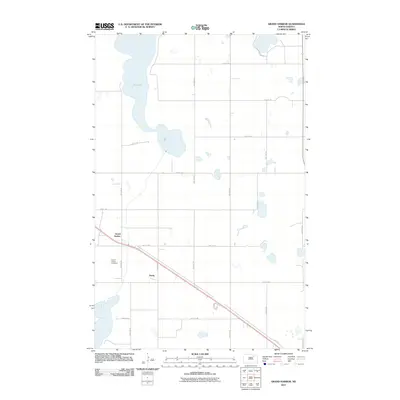
2011 Map of Grand Harbor
USGS Topo · Published 2011About this map
Dry Lake dominates the northwest corner of this Ramsey County landscape, surrounded by the characteristic prairie pothole wetlands of the region. The settlement of Grand Harbor is situated along the main transportation route, where several county roads intersect. This 2011 survey captures the agricultural grid of the North Dakota plains, defined by a network of sectional roads such as 78th Ave NE and 56th St NE. Near the primary highway, the Grand Harbor Cemetery stands as a significant point of interest for genealogists and local historians tracking family roots in this rural community. The map also identifies the small locality of Darby to the southeast, illustrating the sparse but organized settlement pattern of the area as it appeared in the early 21st century.
Find a feature on this map
19 named features on this map. Tap any name to fly to it.
Don’t see what you’re looking for? This feature index may not catch every label — zoom into the map to look around manually.
Map Details
Editions of this 2011 Grand Harbor Map
This is the sole edition of this map. No revisions or reprints were ever made.
Other maps of this area

1931 · Devils Lake
USGS Topo · 1:62,500

1932 · Grahams Island
USGS Topo · 1:62,500

1950 · Grahams Island
USGS Topo · 1:62,500

1950 · Devils Lake
USGS Topo · 1:62,500

1951 · Devils Lake
USGS Topo · 1:24,000

1951 · Grahams Island
USGS Topo · 1:24,000

1951 · Grand Harbor
USGS Topo · 1:24,000

1951 · Camp Grafton
USGS Topo · 1:24,000

1951 · Penn
USGS Topo · 1:24,000

1951 · Sweetwater
USGS Topo · 1:24,000