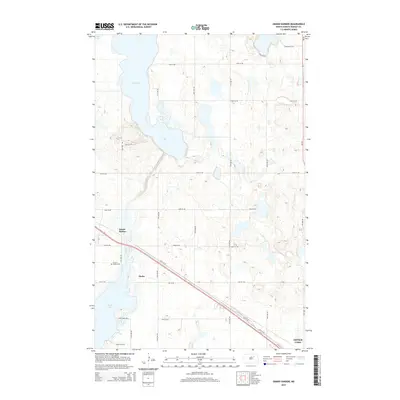
2014 Map of Grand Harbor
USGS Topo · Published 2014About this map
Devils Lake and Dry Lake dominate the northern plains landscape of Ramsey County in this mid-2010s survey. The settlement of Grand Harbor serves as a focal point near the southwestern shore of Dry Lake, connected to the wider region by the prominent corridor of Us-2. This highway cuts diagonally across the terrain, passing through the small community of Darby and skirting the edge of Sixmile Bay.
Find a feature on this map
26 named features on this map. Tap any name to fly to it.
Don’t see what you’re looking for? This feature index may not catch every label — zoom into the map to look around manually.
Map Details
Editions of this 2014 Grand Harbor Map
This is the sole edition of this map. No revisions or reprints were ever made.
Other maps of this area

1931 · Devils Lake
USGS Topo · 1:62,500

1932 · Grahams Island
USGS Topo · 1:62,500

1950 · Grahams Island
USGS Topo · 1:62,500

1950 · Devils Lake
USGS Topo · 1:62,500

1951 · Devils Lake
USGS Topo · 1:24,000

1951 · Grahams Island
USGS Topo · 1:24,000

1951 · Grand Harbor
USGS Topo · 1:24,000

1951 · Camp Grafton
USGS Topo · 1:24,000

1951 · Penn
USGS Topo · 1:24,000

1951 · Sweetwater
USGS Topo · 1:24,000