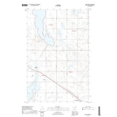
2017 Map of Grand Harbor
USGS Topo · Published 2017About this map
Grand Harbor and the northern reaches of Devils Lake characterize this landscape in Ramsey County. The area reflects a classic North Dakota prairie environment, where large intermittent bodies of water like Dry Lake dominate the northern terrain while the primary settlement cluster of Grand Harbor is positioned along the southern transportation corridors. Notable for local history, the Grand Harbor Cemetery stands near the main townsite, providing a fixed point for genealogical research. The map also shows the rail-aligned community of Darby situated near the inlets of Sixmile Bay. This environment is defined by its seasonal water levels and the grid of section lines that organize the rural farmland, punctuated by emerging residential clusters such as those along Sunny Hills Dr S and Schwan Ave NW near the lakefront.
Find a feature on this map
26 named features on this map. Tap any name to fly to it.
Don’t see what you’re looking for? This feature index may not catch every label — zoom into the map to look around manually.
Map Details
Editions of this 2017 Grand Harbor Map
This is the sole edition of this map. No revisions or reprints were ever made.
Other maps of this area

1931 · Devils Lake
USGS Topo · 1:62,500

1932 · Grahams Island
USGS Topo · 1:62,500

1950 · Grahams Island
USGS Topo · 1:62,500

1950 · Devils Lake
USGS Topo · 1:62,500

1951 · Devils Lake
USGS Topo · 1:24,000

1951 · Grahams Island
USGS Topo · 1:24,000

1951 · Grand Harbor
USGS Topo · 1:24,000

1951 · Camp Grafton
USGS Topo · 1:24,000

1951 · Penn
USGS Topo · 1:24,000

1951 · Sweetwater
USGS Topo · 1:24,000