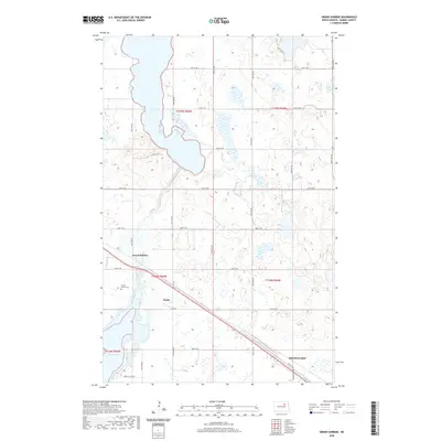
2020 Map of Grand Harbor
USGS Topo · Published 2020About this map
Grand Harbor and the nearby settlement of Darby anchor this landscape along the northwestern reaches of Devils Lake. The terrain is defined by a dense network of glacial potholes and wetlands, interspersed with agricultural sections and the prominent waters of Dry Lake to the north. A significant transportation corridor, including 14th St NW, cuts diagonally across the southern portion of the sheet, providing a direct link toward the city of Devils Lake. The local history of the area is centered around the small community of Grand Harbor, which features the Grand Harbor Cem, and the more contemporary residential development at Sunny Hills Dr S near the shores of Sixmile Bay. This documentation provides a clear view of the rural township structure and the critical water boundaries that shift across Ramsey County.
Find a feature on this map
27 named features on this map. Tap any name to fly to it.
Don’t see what you’re looking for? This feature index may not catch every label — zoom into the map to look around manually.
Map Details
Editions of this 2020 Grand Harbor Map
This is the sole edition of this map. No revisions or reprints were ever made.
Other maps of this area

1931 · Devils Lake
USGS Topo · 1:62,500

1932 · Grahams Island
USGS Topo · 1:62,500

1950 · Grahams Island
USGS Topo · 1:62,500

1950 · Devils Lake
USGS Topo · 1:62,500

1951 · Devils Lake
USGS Topo · 1:24,000

1951 · Grahams Island
USGS Topo · 1:24,000

1951 · Grand Harbor
USGS Topo · 1:24,000

1951 · Camp Grafton
USGS Topo · 1:24,000

1951 · Penn
USGS Topo · 1:24,000

1951 · Sweetwater
USGS Topo · 1:24,000