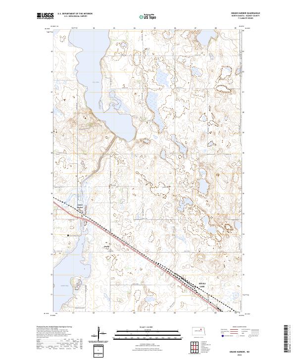
2024 Map of Grand Harbor
USGS Topo · Published 2024About this map
The expansive waters of Devils Lake and its northern reaches dominate this Ramsey County landscape, where the prairie gives way to significant wetland complexes. The settlement of Grand Harbor is situated along the western edge of the quadrangle, supported by the nearby Grand Harbor Cem. Further east, the community of Darby sits along a primary transportation corridor that cuts diagonally across the southern half of the sheet, bridging the gap between Sixmile Bay and the higher ground to the northeast.
Find a feature on this map
28 named features on this map. Tap any name to fly to it.
Don’t see what you’re looking for? This feature index may not catch every label — zoom into the map to look around manually.
Map Details
Editions of this 2024 Grand Harbor Map
This is the sole edition of this map. No revisions or reprints were ever made.
Other maps of this area

1931 · Devils Lake
USGS Topo · 1:62,500

1932 · Grahams Island
USGS Topo · 1:62,500

1950 · Grahams Island
USGS Topo · 1:62,500

1950 · Devils Lake
USGS Topo · 1:62,500

1951 · Devils Lake
USGS Topo · 1:24,000

1951 · Grahams Island
USGS Topo · 1:24,000

1951 · Grand Harbor
USGS Topo · 1:24,000

1951 · Camp Grafton
USGS Topo · 1:24,000

1951 · Penn
USGS Topo · 1:24,000

1951 · Sweetwater
USGS Topo · 1:24,000