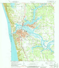
1972 Map of Grand Haven
USGS Topo · Published 1989About this map
Grand Haven serves as the focal point of this 1970s coastal survey, situated where the Grand River meets Lake Michigan. The landscape is defined by an intricate network of bayous and islands, including Harbor Island, Eastmans Island, and Martinique Island, which create a complex waterfront for the tri-cities area. Transport infrastructure is prominent, featuring the Chesapeake and Ohio railroad corridor and the Grand Haven Memorial Airpark. The presence of several historic spiritual sites such as Crockery Chapel and Nortonville Chapel, alongside the extensive Lake Forest Cemetery, provides significant data for genealogical research. The map also highlights the maritime heritage of the region, specifically marking the Coast Guard Sta and the Lighthouse guarding the harbor entrance near Grand Haven State Park.
Find a feature on this map
84 named features on this map. Tap any name to fly to it.
Don’t see what you’re looking for? This feature index may not catch every label — zoom into the map to look around manually.
Map Details
Editions of this 1972 Grand Haven Map
3 editions found
Other maps of this area

1929 · Holland
USGS Topo · 1:62,500

1930 · Lake Harbor
USGS Topo · 1:48,000

1930 · Muskegon
USGS Topo · 1:62,500

1932 · Holland
USGS Topo · 1:62,500

1936 · Muskegon
USGS Topo · 1:62,500

1936 · Lake Harbor
USGS Topo · 1:62,500

1954 · Milwaukee
USGS Topo · 1:250,000

1958 · Milwaukee
USGS Topo · 1:250,000

1958 · Racine
USGS Topo · 1:250,000

1962 · Racine
USGS Topo · 1:250,000