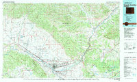
1981 Map of Grand Junction
USGS Topo · Published 1981About this map
The Colorado River and Gunnison River converge at the heart of this 1981 survey, defining the development of the Grand Valley. Irrigation and agricultural patterns are evident in the sprawling orchards and settlements of Orchard Mesa, Palisade, and Fruita. The Denver and Rio Grande Western Railroad follows the river corridor, serving the industrial needs of the Cameo Mine and Palisade Mines near the narrow passage of De Beque Canyon.
Find a feature on this map
85 named features on this map. Tap any name to fly to it.
Don’t see what you’re looking for? This feature index may not catch every label — zoom into the map to look around manually.
Map Details
Editions of this 1981 Grand Junction Map
This is the sole edition of this map. No revisions or reprints were ever made.
Other maps of this area

1885 · East Tavaputs
USGS Topo · 1:250,000

1885 · La Sal
USGS Topo · 1:250,000

1906 · Grand Hogback
USGS Topo · 1:125,000

1910 · Grand Hogback
USGS Topo · 1:125,000

1925 · Parachute Creek
USGS Topo · 1:62,500

1927 · Parachute Creek
USGS Topo · 1:62,500

1929 · Grand Valley
USGS Topo · 1:62,500

1929 · Highmore
USGS Topo · 1:62,500

1929 · Roan Creek
USGS Topo · 1:62,500

1934 · Colorado National Monument
USGS Topo · 1:24,000