
1954 Map of Grand Lake East SE
USGS Topo · Published 1954About this map
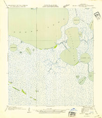
White Lake dominates this coastal landscape on the border of Cameron Parish and Vermilion Parish, where the marshy terrain of the mid-1950s is defined by its waterborne transit routes. Rather than roads, the map details an intricate network of pirogue paths used by hunters and locals, including the Guidry Pirogue Trail, Sweet Bay Pirogue Trail, and Gang Pirogue Trail. These trails provided the primary access through the wetlands surrounding Lake Le Bleu and Turtle Lake to reaches like the Crowley Hunting Club. The presence of the Florence Canal and Prairie Ditch alongside more traditional landmarks like the Crowley Hunting Club Camp highlights the specialized water-and-wildlife economy of south Louisiana. The detailed mapping of Blackfish Bayou and the nearby Intracoastal Waterway illustrates a region where deep-water navigation and shallow-water hunting grounds exist side-by-side.
Find a feature on this map
15 named features on this map. Tap any name to fly to it.
Don’t see what you’re looking for? This feature index may not catch every label — zoom into the map to look around manually.
Map Details
Editions of this 1954 Grand Lake East SE Map
This is the sole edition of this map. No revisions or reprints were ever made.
Other maps of this area

1932 · Constance Bayou NE
USGS Topo · 1:31,680

1932 · Constance Bayou NW
USGS Topo · 1:31,680

1945 · Pecan Island NW
USGS Topo · 1:31,680

1946 · Schooner Bayou NW
USGS Topo · 1:31,680

1946 · Schooner Bayou SW
USGS Topo · 1:31,680

1951 · Pecan Island
USGS Topo · 1:62,500

1953 · Jacks Point Island
USGS Topo · 1:24,000

1954 · Grand Lake East NW
USGS Topo · 1:31,680
1954 · Grand Lake East SW
USGS Topo · 1:31,680
1954 · Schooner Bayou NW
USGS Topo · 1:31,680