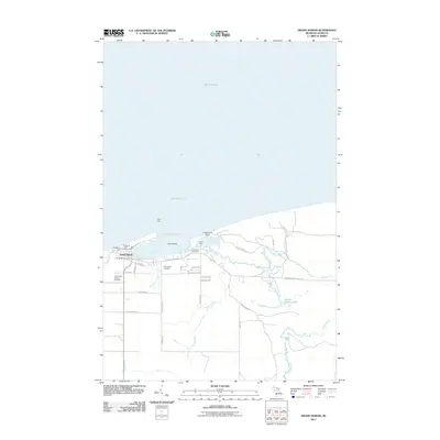
2011 Map of Grand Marais
USGS Topo · Published 2011About this map
Grand Marais serves as a critical maritime anchor along the southern shore of Lake Superior, centered around its protected Harbor of Refuge. This shoreline landscape is defined by the twin basins of West Bay and East Bay, separated by the sandy projection of Lonesome Point. The map details the transition from the lakeside village to the inland hydrology of the Sucker River and Grand Marais Creek, which feed into Grand Marais Lake.
Find a feature on this map
43 named features on this map. Tap any name to fly to it.
Don’t see what you’re looking for? This feature index may not catch every label — zoom into the map to look around manually.
Map Details
Editions of this 2011 Grand Marais Map
This is the sole edition of this map. No revisions or reprints were ever made.
Other maps of this area

1954 · Sault Sainte Marie
USGS Topo · 1:250,000

1956 · Sault Sainte Marie
USGS Topo · 1:250,000

1957 · Sault Sainte Marie
USGS Topo · 1:250,000

1958 · Sault Sainte Marie
USGS Topo · 1:250,000

1958 · Marquette
USGS Topo · 1:250,000

1960 · Marquette
USGS Topo · 1:250,000

1961 · Marquette
USGS Topo · 1:250,000

1966 · Au Sable Point SE
USGS Topo · 1:24,000
1966 · Grand Sable Lake
USGS Topo · 1:24,000
1968 · Nawakwa Lake
USGS Topo · 1:24,000