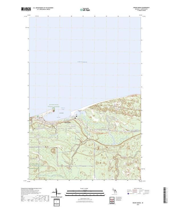
2023 Map of Grand Marais
USGS Topo · Published 2023About this map
Grand Marais serves as a primary northern gateway to the Pictured Rocks National Lakeshore, situated where the shoreline of Lake Superior forms the protected Harbor of Refuge. This coastal landscape is defined by the transition from the West Bay and East Bay waters to a dense network of forest roads and hiking paths, including the North Country National Scenic Trl which skirts the bluffs. Genealogists and local historians can find several significant burial sites, such as Rose Hill Cem, the Holy Rosary Catholic Cem, and the uniquely noted Bird Grave. Moving inland, the terrain is shaped by the Sucker River and Grand Marais Lake, with the Up8 Trl Grand Marais Truck Trl providing deep access into the surrounding Alger County woodlands.
Find a feature on this map
81 named features on this map. Tap any name to fly to it.
Don’t see what you’re looking for? This feature index may not catch every label — zoom into the map to look around manually.
Map Details
Editions of this 2023 Grand Marais Map
This is the sole edition of this map. No revisions or reprints were ever made.
Other maps of this area

1954 · Sault Sainte Marie
USGS Topo · 1:250,000

1956 · Sault Sainte Marie
USGS Topo · 1:250,000

1957 · Sault Sainte Marie
USGS Topo · 1:250,000

1958 · Sault Sainte Marie
USGS Topo · 1:250,000

1958 · Marquette
USGS Topo · 1:250,000

1960 · Marquette
USGS Topo · 1:250,000

1961 · Marquette
USGS Topo · 1:250,000

1966 · Au Sable Point SE
USGS Topo · 1:24,000
1966 · Grand Sable Lake
USGS Topo · 1:24,000
1968 · Nawakwa Lake
USGS Topo · 1:24,000