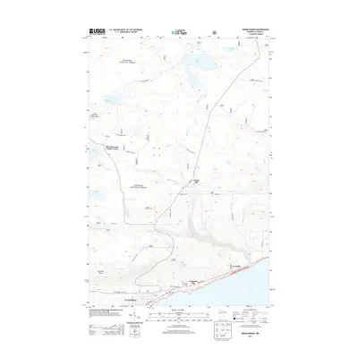
2013 Map of Grand Marais
USGS Topo · Published 2013About this map
Grand Marais serves as the focal point for this North Shore landscape, where the rugged topography of Sawtooth Bluff drops toward the Lake Superior coastline. In the early 21st century, the area shows a transition from the structured township of the village to the expansive reaches of the Superior National Forest. Local history is preserved at several distinct burial sites, including Maple Hill Cem, Chippewa City Cem, and Saint John's Cem, reflecting the area's diverse settlement heritage. Water defines the interior, with the Devil Track River and Little Devil Track River carving through the terrain. The presence of the Grand Marais/Cook County Airport and the Go-Fer Campground highlights the region's importance for both local infrastructure and seasonal tourism, while settlements like Chippewa City and Croftville remain anchored along State Hwy 61.
Find a feature on this map
43 named features on this map. Tap any name to fly to it.
Don’t see what you’re looking for? This feature index may not catch every label — zoom into the map to look around manually.
Map Details
Editions of this 2013 Grand Marais Map
This is the sole edition of this map. No revisions or reprints were ever made.
Other maps of this area

1919 · Grand Marais
USGS Topo · 1:62,500

1954 · Two Harbors
USGS Topo · 1:250,000

1957 · Two Harbors
USGS Topo · 1:250,000

1958 · Two Harbors
USGS Topo · 1:250,000

1958 · Good Harbor Bay
USGS Topo · 1:24,000

1959 · Northern Light Lake
USGS Topo · 1:24,000

1959 · Pine Mountain
USGS Topo · 1:24,000

1959 · Lima Mountain
USGS Topo · 1:24,000

1960 · Grand Marais
USGS Topo · 1:24,000
1960 · Kadunce Creek
USGS Topo · 1:24,000