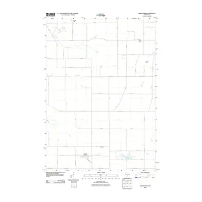
2010 Map of Grand Marsh
USGS Topo · Published 2010About this map
The unincorporated settlement of Grand Marsh anchors the southern portion of this central Wisconsin landscape, situated along a north-south railroad line. This 2010 survey shows the area's transition from high bluffs and cliffs in the north to the lower wetlands and water bodies of the south. Terrain features such as Preston Cliffs, Pilot Knob Bluff, and Spring Bluff provide significant topographic relief above the grid of rural roads. The hydrology of the region is defined by Fordham Creek in the northwest and Duck Creek further south, which feeds into Patrick Lake. Near the center of the township's primary road network, Gould Rock Cemetery serves as a key landmark for local genealogists and historians. The map documents a classic Midwestern section-line road system, including County Hwy-M and County Hwy-G, that connects these scattered farmsteads and natural features.
Find a feature on this map
43 named features on this map. Tap any name to fly to it.
Don’t see what you’re looking for? This feature index may not catch every label — zoom into the map to look around manually.
Map Details
Editions of this 2010 Grand Marsh Map
This is the sole edition of this map. No revisions or reprints were ever made.
Other maps of this area

1955 · Green Bay
USGS Topo · 1:250,000

1957 · Madison
USGS Topo · 1:250,000

1958 · Arkdale
USGS Topo · 1:48,000

1958 · Coloma
USGS Topo · 1:48,000

1960 · Madison
USGS Topo · 1:250,000

1961 · Oxford
USGS Topo · 1:62,500

1961 · Adams
USGS Topo · 1:62,500

1967 · Roche A Cri
USGS Topo · 1:24,000

1968 · Coloma SW
USGS Topo · 1:24,000

1968 · Coloma
USGS Topo · 1:24,000