
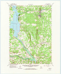
1961 Map of Adams
USGS Topo · Published 1963About this map
The Wisconsin River corridor defines the western edge of this 1961 survey, where the massive Castle Rock Flowage has transformed the landscape. To the east, the neighboring communities of Adams and Friendship serve as the central hubs for a region characterized by a mix of wooded swamplands and dramatic glacial remnants. These geographic features, such as the towering Friendship Mound and Quincy Bluff, rise sharply above the level plains of Strongs Prairie.
Find a feature on this map
59 named features on this map. Tap any name to fly to it.
Don’t see what you’re looking for? This feature index may not catch every label — zoom into the map to look around manually.
Map Details
Editions of this 1961 Adams Map
2 editions found
Other maps of this area

1901 · The Dells
USGS Topo · 1:62,500

1902 · Briggsville
USGS Topo · 1:62,500

1921 · Mauston
USGS Topo · 1:62,500

1953 · Eau Claire
USGS Topo · 1:250,000

1955 · Green Bay
USGS Topo · 1:250,000

1956 · Reedsburg
USGS Topo · 1:62,500

1957 · Wisconsin Dells
USGS Topo · 1:62,500

1957 · Madison
USGS Topo · 1:250,000

1958 · Eau Claire
USGS Topo · 1:250,000

1958 · Briggsville
USGS Topo · 1:62,500