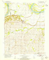
1953 Map of Grand Pass
USGS Topo · Published 1955About this map
The Missouri River defines the northern edge of this landscape, its path constrained by a complex system of levees as it separates Saline, Lafayette, and Carroll Counties. Just south of the floodplain, the settlement of Grand Pass sits elevated on a distinctive ridge, serving as a historic transit point. This topography is mirrored to the south by the Elmwood region and the community of Mt Leonard. The transport network of the early 1950s is clearly visible, with the Missouri Pacific and G M & O railroads cutting through the terrain to support the local agricultural economy.
Find a feature on this map
20 named features on this map. Tap any name to fly to it.
Don’t see what you’re looking for? This feature index may not catch every label — zoom into the map to look around manually.
Map Details
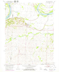
Editions of this 1953 Grand Pass Map
2 editions found
Other maps of this area

1889 · Lexington
USGS Topo · 1:125,000

1890 · Marshall
USGS Topo · 1:125,000

1892 · Marshall
USGS Topo · 1:125,000

1901 · Marshall
USGS Topo · 1:125,000

1951 · Alma
USGS Topo · 1:24,000

1951 · Miami Station
USGS Topo · 1:24,000

1951 · Carrollton East
USGS Topo · 1:24,000

1951 · Waverly
USGS Topo · 1:24,000

1953 · Moberly
USGS Topo · 1:250,000
1953 · Blackburn
USGS Topo · 1:24,000