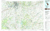
1984 Map of Grand Rapids
USGS Topo · Published 1984About this map
The Grand River carves through the heart of West Michigan, anchoring a landscape that in the early 1980s balanced rapid suburban expansion with vast protected natural areas. This survey captures Grand Rapids and its growing neighbors like Wyoming, Kentwood, and Walker during a period of significant regional integration. Educational institutions such as Aquinas College and Calvin Knollcrest College are established landmarks, while the Kent County International Airport serves as a modern transportation hub.
Find a feature on this map
211 named features on this map. Tap any name to fly to it.
Don’t see what you’re looking for? This feature index may not catch every label — zoom into the map to look around manually.
Map Details
Editions of this 1984 Grand Rapids Map
This is the sole edition of this map. No revisions or reprints were ever made.
Other maps of this area

1914 · Grand Rapids
USGS Topo · 1:62,500

1916 · Kalamazoo
USGS Topo · 1:62,500

1916 · Ionia
USGS Topo · 1:62,500

1918 · Kalamazoo
USGS Topo · 1:62,500

1918 · Cedar Springs
USGS Topo · 1:62,500

1918 · Battle Creek
USGS Topo · 1:62,500

1918 · Ionia
USGS Topo · 1:62,500

1918 · Galesburg
USGS Topo · 1:62,500

1918 · Lowell
USGS Topo · 1:62,500

1921 · Marshall
USGS Topo · 1:62,500