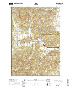
2020 Map of Grand Ronde
USGS Topo · Published 2020About this map
Grand Ronde Agency and the nearby settlement of Grand Ronde anchor this survey of the northwestern corner of the Polk and Yamhill county line. The landscape is defined by the winding course of the South Yamhill River and its numerous tributaries, including Agency Cr and Cosper Cr, which flow through the valley floors beneath Spirit Mtn and Mule Tail Ridge. This area shows a clear transition from the more developed crossroads at Valley Junction and Fort Hill to the forested slopes of the Coast Range.
Find a feature on this map
66 named features on this map. Tap any name to fly to it.
Don’t see what you’re looking for? This feature index may not catch every label — zoom into the map to look around manually.
Map Details
Editions of this 2020 Grand Ronde Map
This is the sole edition of this map. No revisions or reprints were ever made.
Other maps of this area

1942 · Sheridan
USGS Topo · 1:62,500

1942 · Spirit Mtn
USGS Topo · 1:62,500

1942 · Valsetz
USGS Topo · 1:62,500

1942 · Dallas
USGS Topo · 1:62,500

1948 · Vancouver
USGS Topo · 1:250,000

1950 · Vancouver
USGS Topo · 1:250,000

1950 · Vancouver
USGS Topo · 1:250,000

1953 · Salem
USGS Topo · 1:250,000

1954 · Salem
USGS Topo · 1:250,000

1955 · Grand Ronde
USGS Topo · 1:62,500