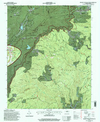
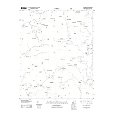
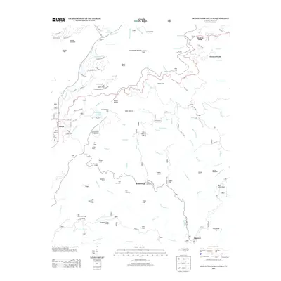
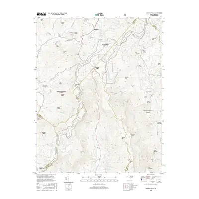
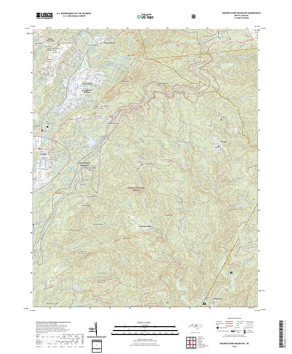
1994 Map of Grandfather Mountain
USGS Topo · Published 1998About this map
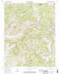
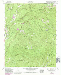
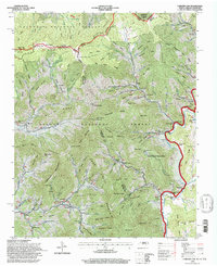
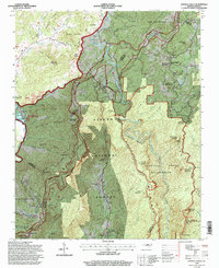
Grandfather Mountain dominates this mid-1990s survey, marking a complex intersection of the Blue Ridge crest and the headwaters of the Watauga River. The landscape is defined by the sweeping Parkway Boundary of the Blue Ridge Parkway, which winds past prominent landmarks like The Sphinx Rock, Beacon Heights, and Black Rock Cliffs. Away from the tourist thoroughfare, the map reveals the scattered community life of the High Country. The settlement of Linville sits to the west, while smaller locales like Gragg and Edgemont are found tucked along the drainage of Wilson Creek. Genealogists will find several sites of interest, including the Hopkins Chapel Cemetery near Ned Mountain and the Cary Flat Cemetery further east. This map provides a detailed view of the terrain within the Pisgah National Forest just before the turn of the century, documenting the network of mountain branches and gaps that have shaped local travel and settlement for generations.
Find a feature on this map
81 named features on this map. Tap any name to fly to it.
Don’t see what you’re looking for? This feature index may not catch every label — zoom into the map to look around manually.
Map Details
Editions of this 1994 Grandfather Mountain Map
This is the sole edition of this map. No revisions or reprints were ever made.
Historical Maps of Seven Devils Through Time
25 maps found
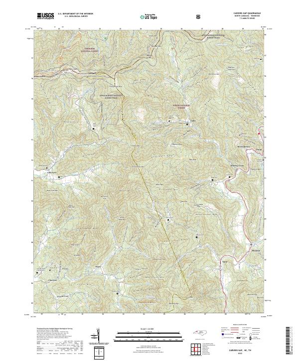
1934 Carvers Gap
Avery County, NC

1934 Linville Falls
Avery County, NC

1935 Doe Mountain
Avery County, NC
1955 Carvers Gap
Avery County, NC
1956 Linville Falls
Avery County, NC
1960 Carvers Gap
Avery County, NC
1960 Grandfather Mountain
Avery County, NC
1994 Carvers Gap
Avery County, NC
1994 Grandfather Mountain
Avery County, NC
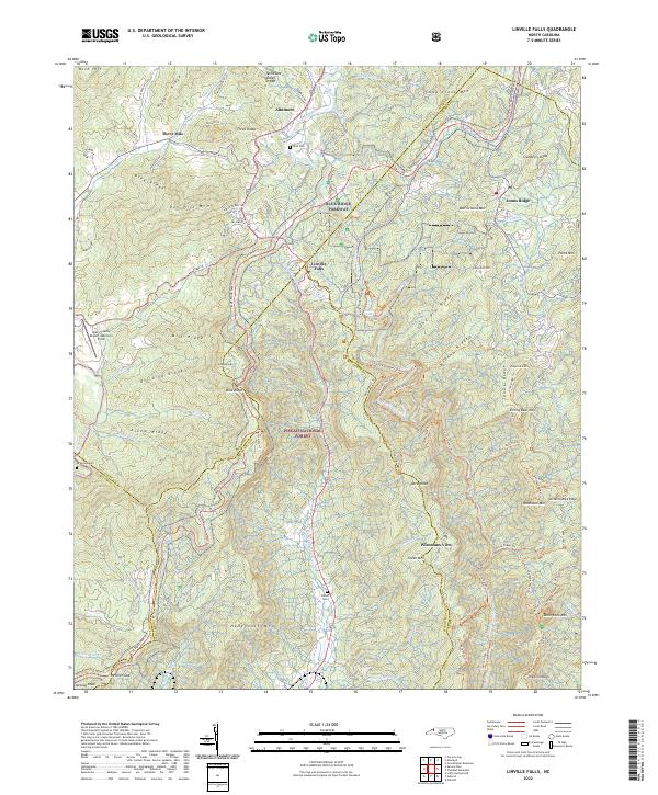
1994 Linville Falls
Avery County, NC
2011 Carvers Gap
Avery County, NC
2011 Grandfather Mountain
Avery County, NC
2011 Linville Falls
Avery County, NC
2013 Carvers Gap
Avery County, NC
2013 Grandfather Mountain
Avery County, NC
2013 Linville Falls
Avery County, NC
2016 Carvers Gap
Avery County, NC
2016 Grandfather Mountain
Avery County, NC
2016 Linville Falls
Avery County, NC
2019 Carvers Gap
Avery County, NC
2019 Grandfather Mountain
Avery County, NC
2019 Linville Falls
Avery County, NC
2022 Carvers Gap
Avery County, NC
2022 Grandfather Mountain
Avery County, NC
2022 Linville Falls
Avery County, NC