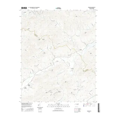
2016 Map of Grandin
USGS Topo · Published 2016About this map
Fort Defiance stands as a primary landmark in this upland region where the Yadkin River and Elk Creek carve through the foothills of the Warrior Mountains. The landscape is defined by the sharp boundary between Wilkes and Caldwell Counties, following the heights of County Line Ridge and Wheat Patch Mtn. Small settlements like Grandin, Elkville, and Yadkin Valley are connected by a network of winding roads, including the notable Tom Dula Rd. Local history is anchored by sites such as Sherrill Hill Cem and Mount Bethel Cem, which serve as genealogical touchstones for families settled among the numerous named peaks like Chestnut Mtn and Butte Mtn. The map reveals a transition from river valley bottomlands to the steep, creek-fed ridges of Elk Ridge and Sly Mtn.
Find a feature on this map
77 named features on this map. Tap any name to fly to it.
Don’t see what you’re looking for? This feature index may not catch every label — zoom into the map to look around manually.
Map Details
Editions of this 2016 Grandin Map
This is the sole edition of this map. No revisions or reprints were ever made.
Other maps of this area

1889 · Wilkesboro
USGS Topo · 1:125,000

1891 · Wilkesboro
USGS Topo · 1:125,000

1893 · Cranberry
USGS Topo · 1:125,000

1895 · Hickory
USGS Topo · 1:125,000

1895 · Cranberry
USGS Topo · 1:125,000

1899 · Cranberry
USGS Topo · 1:125,000

1902 · Cranberry
USGS Topo · 1:125,000

1905 · Morganton
USGS Topo · 1:125,000

1936 · Blowing Rock
USGS Topo · 1:48,000

1942 · Blowing Rock
USGS Topo · 1:62,500