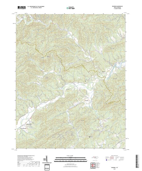
2022 Map of Grandin
USGS Topo · Published 2022About this map
Fort Defiance and the headwaters of the Yadkin River anchor this topographic study of the Appalachian foothills. The landscape is defined by the sharp relief of the Warrior Mountains and the winding course of Elk Creek as it flows toward Elkville. Evidence of the area's rural heritage is preserved in the location of Mount Bethel Cem and Sherrill Hill Cem, alongside small settlements like Darby and Grandin. The road network traces the difficult terrain, with routes like Elk Creek Darby Rd and Tom Dula Rd following the natural contours of the ridges and valleys. A notable boundary between Wilkes and Caldwell counties zigzags across high points like County Line Ridge and Wheat Patch Mtn, illustrating how the physical geography of Sly Mtn and Chestnut Mtn dictated political divisions in this corner of North Carolina.
Find a feature on this map
74 named features on this map. Tap any name to fly to it.
Don’t see what you’re looking for? This feature index may not catch every label — zoom into the map to look around manually.
Map Details
Editions of this 2022 Grandin Map
This is the sole edition of this map. No revisions or reprints were ever made.
Other maps of this area

1889 · Wilkesboro
USGS Topo · 1:125,000

1891 · Wilkesboro
USGS Topo · 1:125,000

1893 · Cranberry
USGS Topo · 1:125,000

1895 · Hickory
USGS Topo · 1:125,000

1895 · Cranberry
USGS Topo · 1:125,000

1899 · Cranberry
USGS Topo · 1:125,000

1902 · Cranberry
USGS Topo · 1:125,000

1905 · Morganton
USGS Topo · 1:125,000

1936 · Blowing Rock
USGS Topo · 1:48,000

1942 · Blowing Rock
USGS Topo · 1:62,500