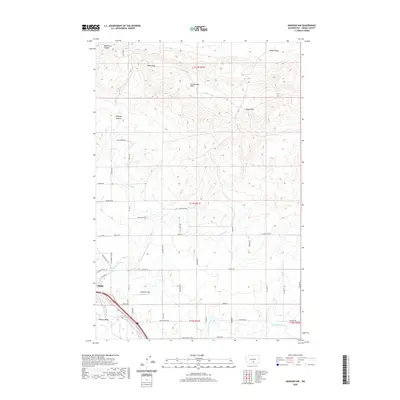
2020 Map of Granger NW
USGS Topo · Published 2020About this map
Zillah and the surrounding Yakima Valley orchard lands are defined by the sophisticated irrigation network that transforms this arid landscape. The Roza Canal and Sunnyside Canal trace the contours of the foothills, providing the vital water supply that sustains local agriculture. To the north, the terrain rises sharply into the Rattlesnake Hills, punctuated by prominent landmarks such as Zillah Peak and Eagle Peak.
Find a feature on this map
52 named features on this map. Tap any name to fly to it.
Don’t see what you’re looking for? This feature index may not catch every label — zoom into the map to look around manually.
Map Details
Editions of this 2020 Granger NW Map
This is the sole edition of this map. No revisions or reprints were ever made.
Other maps of this area

1910 · Zillah
USGS Topo · 1:125,000

1936 · Yakima East
USGS Topo · 1:48,000

1936 · Hog Ranch Buttes
USGS Topo · 1:48,000

1941 · Black Rock Spring
USGS Topo · 1:62,500

1941 · Yakima East
USGS Topo · 1:62,500

1950 · Yakima
USGS Topo · 1:250,000
1953 · Black Rock Spring SW
USGS Topo · 1:24,000

1953 · Elephant Mountain
USGS Topo · 1:24,000
1953 · Black Rock Spring
USGS Topo · 1:24,000
1953 · Black Rock Spring
USGS Topo · 1:62,500