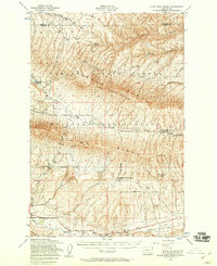
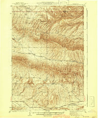
1953 Map of Black Rock Spring
USGS Topo · Published 1958About this map
Yakima Firing Center dominates this mid-century landscape in Yakima County, reflecting the area's transition into a major military training site. The terrain is defined by dramatic geological features including Umtanum Ridge, Yakima Ridge, and the Hog Ranch Buttes. Between these uplands, the map traces early agricultural and ranching footprints, such as the Mackintosh-Douglas Ranch and Holmes Ranch.
Find a feature on this map
29 named features on this map. Tap any name to fly to it.
Don’t see what you’re looking for? This feature index may not catch every label — zoom into the map to look around manually.
Map Details
Editions of this 1953 Black Rock Spring Map
2 editions found

Other maps of this area

1910 · Zillah
USGS Topo · 1:125,000
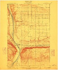
1912 · Beverly
USGS Topo · 1:62,500

1915 · Prosser
USGS Topo · 1:125,000

1917 · Priest Rapids
USGS Topo · 1:62,500

1917 · Prosser
USGS Topo · 1:125,000

1936 · Yakima East
USGS Topo · 1:48,000

1936 · Hog Ranch Buttes
USGS Topo · 1:48,000

1938 · Badger Pocket
USGS Topo · 1:48,000

1939 · Boylston
USGS Topo · 1:48,000
1941 · Black Rock Spring
USGS Topo · 1:62,500