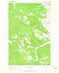
1968 Map of Granite Butte
USGS Topo · Published 1971About this map
Granite Butte stands as a prominent landmark along the crest of the Continental Divide, where the waters split toward the Pacific and the Atlantic. This high-altitude landscape within the Helena National Forest is defined by its deep mining heritage, evidenced by the Poorman Mines and numerous unnamed prospects scattered across the gulches. The terrain is a network of drainage systems, with Gould Creek and Bear Creek carving into the northern slopes while Little Prickly Pear Creek winds through the central valley.
Find a feature on this map
33 named features on this map. Tap any name to fly to it.
Don’t see what you’re looking for? This feature index may not catch every label — zoom into the map to look around manually.
Map Details
Editions of this 1968 Granite Butte Map
3 editions found
Other maps of this area

1889 · Helena
USGS Topo · 1:250,000

1893 · Helena
USGS Topo · 1:250,000

1899 · Helena
USGS Topo · 1:250,000

1903 · Helena
USGS Topo · 1:250,000

1947 · Butte
USGS Topo · 1:250,000

1958 · Butte
USGS Topo · 1:250,000

1958 · Avon
USGS Topo · 1:62,500

1959 · Elliston
USGS Topo · 1:62,500

1960 · Butte
USGS Topo · 1:250,000

1962 · Butte
USGS Topo · 1:250,000