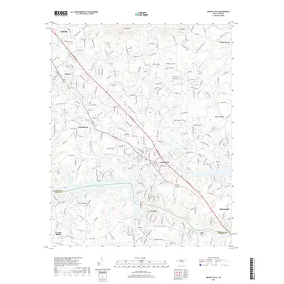
2019 Map of Granite Falls
USGS Topo · Published 2019About this map
Granite Falls and the surrounding Catawba Valley riverfront are defined by the expansive waters of Rhodhiss Lake and Lake Hickory in this 2019 survey. The landscape transitions from the developed corridors along Hickory Blvd to the more rural heights of Chestnut Mtn and Pilot Mtn in the north. The map documents the residential patterns of several established communities, including Sawmills, Hudson, and Rhodhiss, where local history is anchored by sites like Sunset Hill Cem and Pinecrest Cem. This modern topographic study shows the intensive road network connecting older settlements like Dudley Shoals and Grace Chapel to the larger centers of Lenoir and Hickory. The intricate shoreline and numerous creek systems, such as Gunpowder Creek and Drowning Creek, highlight the vital role of these water bodies in defining local property lines and the geographic character of both Caldwell and Burke counties.
Find a feature on this map
226 named features on this map. Tap any name to fly to it.
Don’t see what you’re looking for? This feature index may not catch every label — zoom into the map to look around manually.
Map Details
Editions of this 2019 Granite Falls Map
This is the sole edition of this map. No revisions or reprints were ever made.
Other maps of this area

1895 · Hickory
USGS Topo · 1:125,000

1905 · Morganton
USGS Topo · 1:125,000

1953 · Charlotte
USGS Topo · 1:250,000

1954 · Charlotte
USGS Topo · 1:250,000

1956 · Valdese
USGS Topo · 1:24,000

1956 · Lenoir
USGS Topo · 1:24,000

1956 · Drexel
USGS Topo · 1:24,000

1956 · Lenoir
USGS Topo · 1:62,500

1960 · Charlotte
USGS Topo · 1:250,000

1962 · Charlotte
USGS Topo · 1:250,000