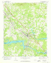
1970 Map of Granite Falls
USGS Topo · Published 1973About this map
Rhodhiss Lake and the Catawba River form the southern boundary of this Piedmont landscape, dominated by the industrial and residential growth of Granite Falls and Hudson along the Southern railroad line. The map illustrates a transitional period where rural traditions meet mid-century development, evidenced by the proximity of the Hudson Drag Strip and Caldwell Community College to numerous established country churches like Mt Zion Ch and Poovey Chapel. The topography is defined by the descent toward the river valley, with prominent elevations like Chestnut Mtn and Pilot Mtn overlooking a network of creeks. Downstream from the Rhodhiss Dam, the waterway transitions into Hickory Lake, while inland features such as the Old Millpond on Gunpowder Creek point to older patterns of water-powered industry and community centers like Dudley Shoals.
Find a feature on this map
53 named features on this map. Tap any name to fly to it.
Don’t see what you’re looking for? This feature index may not catch every label — zoom into the map to look around manually.
Map Details
Editions of this 1970 Granite Falls Map
This is the sole edition of this map. No revisions or reprints were ever made.
Other maps of this area

1895 · Hickory
USGS Topo · 1:125,000

1905 · Morganton
USGS Topo · 1:125,000

1953 · Charlotte
USGS Topo · 1:250,000

1954 · Charlotte
USGS Topo · 1:250,000

1956 · Valdese
USGS Topo · 1:24,000

1956 · Lenoir
USGS Topo · 1:24,000

1956 · Drexel
USGS Topo · 1:24,000

1956 · Lenoir
USGS Topo · 1:62,500

1960 · Charlotte
USGS Topo · 1:250,000

1962 · Charlotte
USGS Topo · 1:250,000