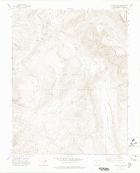
1973 Map of Granite Lake
USGS Topo · Published 1975About this map
Granite Peak Guard Sta serves as a remote point of interest in this high-altitude landscape where the San Juan National Forest meets the Rio Grande National Forest. The geography is defined by the Continental Divide and the deep drainage of the Weminuche Valley, showing a wilderness accessible only by a network of Pack Trails and Foot Trails. The map details a complex hydrologic system where high-country basins like Granite Lake and Divide Lakes feed the headwaters of the Los Pinos River and Weminuche Creek.
Find a feature on this map
27 named features on this map. Tap any name to fly to it.
Don’t see what you’re looking for? This feature index may not catch every label — zoom into the map to look around manually.
Map Details
Editions of this 1973 Granite Lake Map
2 editions found
Other maps of this area

1905 · San Cristobal
USGS Topo · 1:125,000

1907 · San Cristobal
USGS Topo · 1:125,000

1924 · Pagosa Springs
USGS Topo · 1:125,000

1927 · Pagosa Springs
USGS Topo · 1:125,000

1945 · Durango
USGS Topo · 1:250,000

1953 · Durango
USGS Topo · 1:250,000

1954 · Durango
USGS Topo · 1:250,000

1961 · Durango
USGS Topo · 1:250,000

1963 · Durango
USGS Topo · 1:250,000
1964 · Rio Grande Pyramid
USGS Topo · 1:24,000