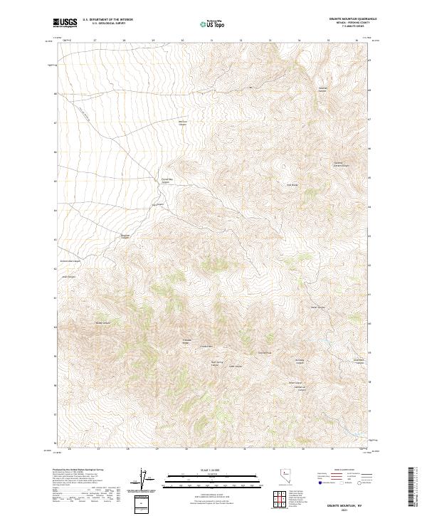
2021 Map of Granite Mountain
USGS Topo · Published 2021About this map
The high elevations of the East Range dominate this part of Pershing County, where the landscape is defined by a dense network of drainages and prominent peaks. Granite Mtn and Granite Peak serve as the primary landmarks in the southern portion of the sheet, with the steep descent of Cinnabar Ridge leading toward the headwaters of Cinnabar Cr. The mapping of these features reveals a geography where water movement is the primary sculptor of the terrain, visible in the convergence of numerous named canyons such as French Boy Canyon, Say Canyon, and McClure Canyon.
Find a feature on this map
29 named features on this map. Tap any name to fly to it.
Don’t see what you’re looking for? This feature index may not catch every label — zoom into the map to look around manually.
Map Details
Editions of this 2021 Granite Mountain Map
This is the sole edition of this map. No revisions or reprints were ever made.
Other maps of this area

1932 · Sonoma Range
USGS Topo · 1:250,000

1939 · Sonoma Range
USGS Topo · 1:250,000

1955 · Winnemucca
USGS Topo · 1:250,000

1958 · Winnemucca
USGS Topo · 1:250,000
1961 · Kyle Hot Springs
USGS Topo · 1:62,500

1961 · Mt. Tobin
USGS Topo · 1:62,500

1961 · Cain Mountain
USGS Topo · 1:62,500

1961 · Fencemaker
USGS Topo · 1:62,500

1962 · Winnemucca
USGS Topo · 1:250,000

1982 · Fish Creek Mts
USGS Topo · 1:100,000