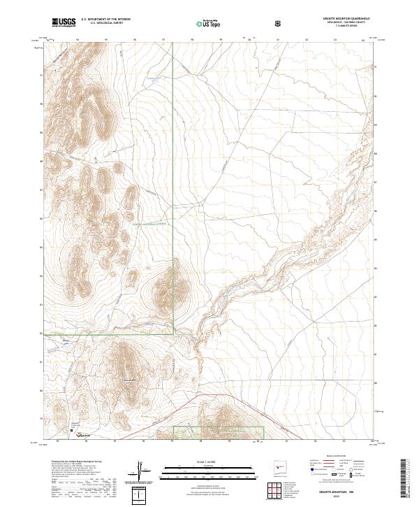
2023 Map of Granite Mountain
USGS Topo · Published 2023About this map
The high desert landscape of Cibola National Forest dominates this topographic study, where the village of Magdalena serves as a lone hub of settlement in the southwest corner. The area is defined by sharp elevation changes and seasonal watercourses, including Ancho Canyon and the winding path of La Jencia Creek. Historical and genealogical markers include the Magdalena Community Cem, while the rugged geography is anchored by the prominent Granite Mtn and the deep incisions of Arroyo Gato. Isolated water sources like Goat Spring, Bird Spring, and the Jornado Tank indicate a land where every reliable spring and tank was a critical landmark for travelers and ranchers. A sparse network of forest routes, such as Forest 354 Rd and Grant Rd, connects the higher peaks of the northern canyons to the lower-lying arroyos and the settlement of Magdalena.
Find a feature on this map
24 named features on this map. Tap any name to fly to it.
Don’t see what you’re looking for? This feature index may not catch every label — zoom into the map to look around manually.
Map Details
Editions of this 2023 Granite Mountain Map
This is the sole edition of this map. No revisions or reprints were ever made.
Other maps of this area

1954 · Socorro
USGS Topo · 1:250,000

1958 · Socorro
USGS Topo · 1:250,000

1959 · Magdalena
USGS Topo · 1:62,500

1959 · Riley
USGS Topo · 1:62,500

1962 · Socorro
USGS Topo · 1:250,000

1963 · Arroyo Landavaso
USGS Topo · 1:24,000

1964 · Silver Hill
USGS Topo · 1:24,000
1964 · Mesa Cencerro
USGS Topo · 1:24,000
1979 · Magdalena
USGS Topo · 1:100,000
1985 · Granite Mountain
USGS Topo · 1:24,000