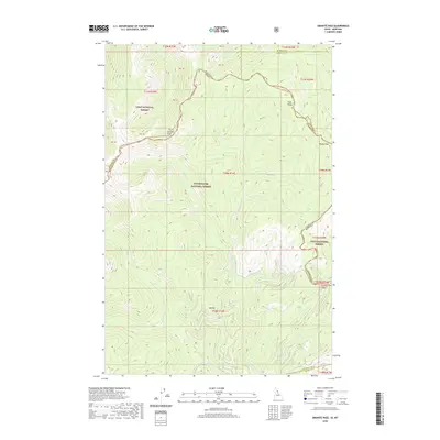
2020 Map of Granite Pass
USGS Topo · Published 2020About this map
The high Bitterroot Divide forms the backbone of this survey, where the state line between Montana and Idaho follows the winding crest of the mountains. This rugged high-altitude landscape is dominated by the massive tracts of the Lolo National Forest and the Clearwater National Forest, meeting at the narrow gap of Granite Pass. The drainage patterns here are sharply defined by the terrain, with waters like the Crooked Fork and Boulder Cr carving deep valleys away from the peaks. Prominent high points such as Granite Peak, Pilot Knob, and Rocky Peak stand as sentinels along the ridgelines, marking the boundary between Missoula, Clearwater, and Idaho counties. This map serves as a detailed record of the forest service infrastructure and natural hydrology in a remote region of the American Northwest.
Find a feature on this map
37 named features on this map. Tap any name to fly to it.
Don’t see what you’re looking for? This feature index may not catch every label — zoom into the map to look around manually.
Map Details
Editions of this 2020 Granite Pass Map
This is the sole edition of this map. No revisions or reprints were ever made.
Other maps of this area

1911 · Lolo
USGS Topo · 1:250,000

1913 · Lolo
USGS Topo · 1:250,000

1956 · Hamilton
USGS Topo · 1:250,000

1959 · Hamilton
USGS Topo · 1:250,000

1960 · Hamilton
USGS Topo · 1:250,000

1960 · Straight Peak
USGS Topo · 1:62,500

1964 · Hamilton
USGS Topo · 1:250,000

1964 · Lolo Hot Springs
USGS Topo · 1:24,000

1964 · Rocky Point
USGS Topo · 1:24,000
1964 · White Mountain
USGS Topo · 1:24,000