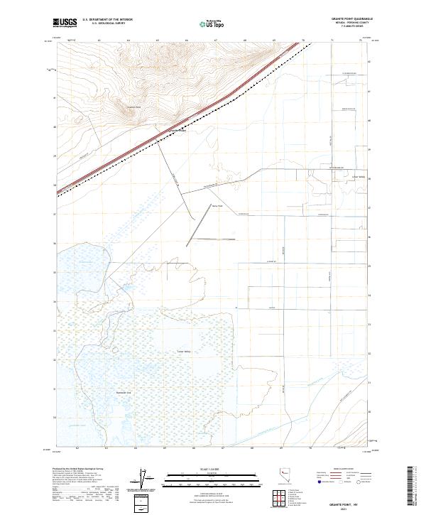
2021 Map of Granite Point
USGS Topo · Published 2021About this map
Humboldt Sink and the expansive waters of Humboldt Lake dominate this Pershing County landscape, where the high desert meets a complex hydraulic network. The terrain is defined by the contrast between the elevation of Granite Point and the low-lying wetlands and drainage systems of the Lower Valley. Water management is central to the area's geography, evidenced by the presence of Seventeen Ditch, Army Drain, and Toulon Drain, which channel water toward the sink.
Find a feature on this map
29 named features on this map. Tap any name to fly to it.
Don’t see what you’re looking for? This feature index may not catch every label — zoom into the map to look around manually.
Map Details
Editions of this 2021 Granite Point Map
This is the sole edition of this map. No revisions or reprints were ever made.
Other maps of this area

1908 · Carson Sink
USGS Topo · 1:250,000

1910 · Carson Sink
USGS Topo · 1:250,000

1931 · Lovelock
USGS Topo · 1:250,000

1935 · Lovelock
USGS Topo · 1:250,000

1951 · Carson Sink
USGS Topo · 1:62,500

1955 · Lovelock
USGS Topo · 1:250,000

1956 · Toulon
USGS Topo · 1:62,500

1956 · Lovelock
USGS Topo · 1:62,500

1957 · Reno
USGS Topo · 1:250,000

1959 · Lovelock
USGS Topo · 1:250,000