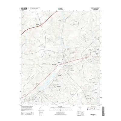
2014 Map of Graniteville
USGS Topo · Published 2014About this map
The industrial and educational landscape of western Aiken County is defined by the valley formed by Horse Creek, where mill ponds and historic settlements cluster along the water's path. In this 2014 survey, the dense residential corridors of Graniteville, Warrenville, and Langley reveal a long-standing settlement pattern anchored by the local geography. Significant local heritage sites are found throughout the area, including Bettis Academy in the north and the campus of the Univ of S Carolina-Aiken near Aiken Heights. The map highlights a high density of burial grounds, from the small Clark Cem and Williams Cem to the sprawling Sunset Memory Gardens. Water features like Langley Pond and Vaucluse Pond provide a visual record of the region’s hydraulic history, serving both the industry of Vaucluse and the surrounding residential communities.
Find a feature on this map
180 named features on this map. Tap any name to fly to it.
Don’t see what you’re looking for? This feature index may not catch every label — zoom into the map to look around manually.
Map Details
Editions of this 2014 Graniteville Map
This is the sole edition of this map. No revisions or reprints were ever made.
Other maps of this area

1920 · Aiken
USGS Topo · 1:48,000

1920 · Talatha
USGS Topo · 1:48,000

1921 · Augusta
USGS Topo · 1:62,500

1921 · Aiken
USGS Topo · 1:62,500

1921 · Talatha
USGS Topo · 1:62,500

1923 · Warrenville
USGS Topo · 1:48,000

1928 · Warrenville
USGS Topo · 1:62,500

1943 · Aiken
USGS Topo · 1:62,500

1943 · Augusta East
USGS Topo · 1:125,000

1943 · Warrenville
USGS Topo · 1:62,500