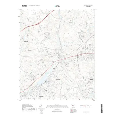
2020 Map of Graniteville
USGS Topo · Published 2020About this map
Horse Creek and its tributaries define the industrial and residential character of this South Carolina landscape, carving a corridor through numerous interconnected communities. The valley is densely settled with neighborhoods like Graniteville, Warrenville, and Gloverville, reflecting a legacy of textile production and mill-village development. Significant water features such as Langley Pond and Williams Lake stand out amidst the rolling terrain, while educational institutions like University of South Carolina Aiken and Aiken Technical College mark the area's modern growth. For genealogists, the map is remarkably dense with burial sites, ranging from the large Graniteville Cem and Sunset Memory Gardens to smaller, family-associated grounds like Carter Cem and Clark Cem. The transition from the urban edge of Aiken into the industrial heart of the valley highlights the region's enduring role as a manufacturing and population hub.
Find a feature on this map
210 named features on this map. Tap any name to fly to it.
Don’t see what you’re looking for? This feature index may not catch every label — zoom into the map to look around manually.
Map Details
Editions of this 2020 Graniteville Map
This is the sole edition of this map. No revisions or reprints were ever made.
Other maps of this area

1920 · Aiken
USGS Topo · 1:48,000

1920 · Talatha
USGS Topo · 1:48,000

1921 · Augusta
USGS Topo · 1:62,500

1921 · Aiken
USGS Topo · 1:62,500

1921 · Talatha
USGS Topo · 1:62,500

1923 · Warrenville
USGS Topo · 1:48,000

1928 · Warrenville
USGS Topo · 1:62,500

1943 · Aiken
USGS Topo · 1:62,500

1943 · Augusta East
USGS Topo · 1:125,000

1943 · Warrenville
USGS Topo · 1:62,500