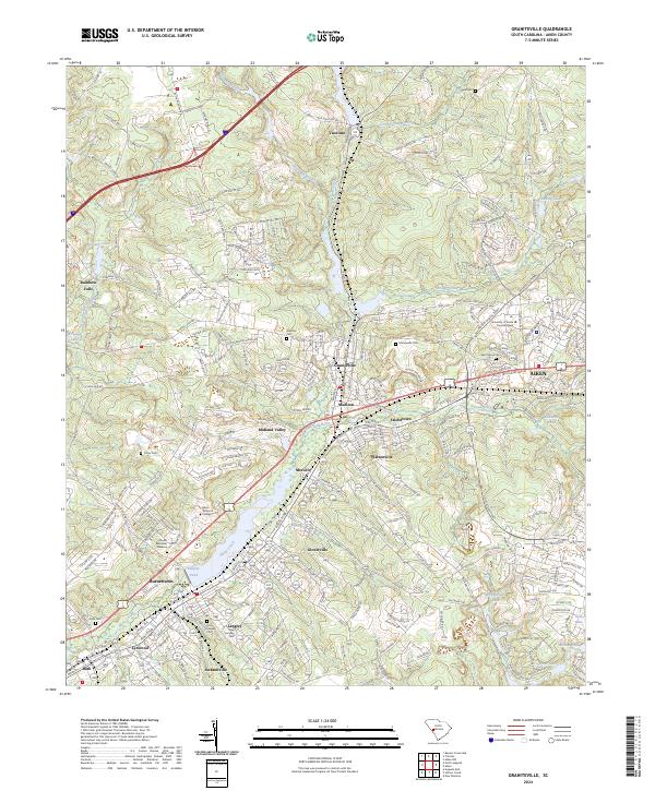
2024 Map of Graniteville
USGS Topo · Published 2024About this map
Horse Creek and its various tributaries, including Sage Mill Branch and Little Horse Creek, define the industrial and residential geography of this Aiken County corridor. The landscape is characterized by a series of mill-era settlements that follow the waterway, stretching from Vaucluse in the north through Graniteville and Warrenville down to Langley and Bath. This map illustrates the dense distribution of local history markers, particularly cemeteries like Vaucluse Cem, Graniteville Cem, and the dual Old and New Langley cemeteries, which offer valuable data for genealogical research.
Find a feature on this map
98 named features on this map. Tap any name to fly to it.
Don’t see what you’re looking for? This feature index may not catch every label — zoom into the map to look around manually.
Map Details
Editions of this 2024 Graniteville Map
This is the sole edition of this map. No revisions or reprints were ever made.
Other maps of this area

1920 · Aiken
USGS Topo · 1:48,000

1920 · Talatha
USGS Topo · 1:48,000

1921 · Augusta
USGS Topo · 1:62,500

1921 · Aiken
USGS Topo · 1:62,500

1921 · Talatha
USGS Topo · 1:62,500

1923 · Warrenville
USGS Topo · 1:48,000

1928 · Warrenville
USGS Topo · 1:62,500

1943 · Aiken
USGS Topo · 1:62,500

1943 · Augusta East
USGS Topo · 1:125,000

1943 · Warrenville
USGS Topo · 1:62,500