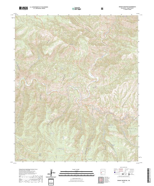
2023 Map of Granny Mountain
USGS Topo · Published 2023About this map
Granny Mtn and the high ridges of the Pinos Altos Range dominate this portion of the Gila Wilderness within the Gila National Forest. The landscape is defined by its network of deep canyons, including Sycamore Canyon, Wild Cow Canyon, and Fall Canyon, which funnel toward the Gila River as it snakes through the center of the quadrangle. For those studying the area's natural history and land use, the presence of numerous named water sources like Miller Spring, Shady Bend Spring, and Pelican Spring highlights the critical importance of these reliable points in a high-elevation arid environment. Long-established paths such as the Granny Mountain Trl and the Snow Creek Trl provide the primary access through this protected backcountry. The southern portion of the sheet transitions into prominent flat-topped features like Maverick Mesa and Wild Horse Mesa, overlooking the confluence of Sapillo Creek and the main river channel.
Find a feature on this map
52 named features on this map. Tap any name to fly to it.
Don’t see what you’re looking for? This feature index may not catch every label — zoom into the map to look around manually.
Map Details
Editions of this 2023 Granny Mountain Map
This is the sole edition of this map. No revisions or reprints were ever made.
Other maps of this area

1909 · Silver City
USGS Topo · 1:125,000

1911 · Alum Mountain
USGS Topo · 1:125,000

1913 · Alum Mountain
USGS Topo · 1:125,000

1947 · Twin Sisters
USGS Topo · 1:24,000

1948 · Twin Sisters
USGS Topo · 1:24,000

1950 · Dorsey Ranch
USGS Topo · 1:24,000

1950 · Reading Mountain
USGS Topo · 1:24,000

1951 · Dorsey Ranch
USGS Topo · 1:24,000
1952 · Reading Mountain
USGS Topo · 1:24,000

1954 · Silver City
USGS Topo · 1:250,000