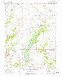
1974 Map of Grant Ford
USGS Topo · Published 1977About this map
Highland Silver Lake dominates the central landscape of this Madison County survey, serving as a primary hydrological and recreational hub for the surrounding townships of Alhambra, Leef, Marine, and Saline. The village of Grantfork sits just north of the lake’s eastern arm, while the northern edge of Highland appears at the southern map margin. The area’s agrarian character is punctuated by several family and parish burial sites, including St Gertrudes Cem, Mundis Cem, and Holtzgang Cem, providing significant touchpoints for local genealogical research.
Find a feature on this map
29 named features on this map. Tap any name to fly to it.
Don’t see what you’re looking for? This feature index may not catch every label — zoom into the map to look around manually.
Map Details
Editions of this 1974 Grant Ford Map
This is the sole edition of this map. No revisions or reprints were ever made.
Other maps of this area

1906 · Breese
USGS Topo · 1:62,500

1907 · Breese
USGS Topo · 1:62,500

1907 · Belleville
USGS Topo · 1:62,500

1927 · Edwardsville
USGS Topo · 1:62,500

1932 · Edwardsville
USGS Topo · 1:62,500

1937 · New Douglas
USGS Topo · 1:48,000

1944 · New Douglas
USGS Topo · 1:62,500

1949 · St. Jacob
USGS Topo · 1:24,000
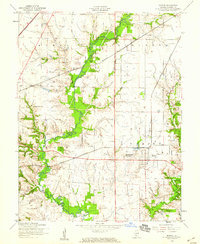
1954 · Marine
USGS Topo · 1:24,000

1954 · Worden
USGS Topo · 1:24,000