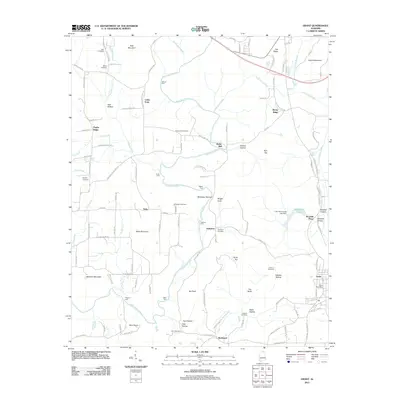
2011 Map of Grant
USGS Topo · Published 2011About this map
The Paint Rock River winds through this section of Marshall County, creating a landscape defined by sharp elevation changes and numerous river crossings. High points like Keel Mountain and Nebo Mountain overlook a valley floor where several historic fords once served local travel, including Hellum Ford, Maple Ford, and Fishtrap Ford. The area is dotted with small settlements such as Nebo, Humpton, and Bucksnort, many associated with family-named landmarks and ancestral burial grounds like the Keel Cemetery and Kennamer Cemetery.
Find a feature on this map
118 named features on this map. Tap any name to fly to it.
Don’t see what you’re looking for? This feature index may not catch every label — zoom into the map to look around manually.
Map Details
Editions of this 2011 Grant Map
This is the sole edition of this map. No revisions or reprints were ever made.
Other maps of this area

1885 · Gadsden
USGS Topo · 1:125,000

1888 · Gadsden
USGS Topo · 1:125,000

1888 · Scottsboro
USGS Topo · 1:125,000

1892 · Scottsboro
USGS Topo · 1:125,000

1892 · Gadsden
USGS Topo · 1:125,000

1895 · Gadsden
USGS Topo · 1:125,000

1903 · Gadsden
USGS Topo · 1:125,000

1936 · Columbus City
USGS Topo · 1:24,000

1936 · New Hope
USGS Topo · 1:24,000

1936 · Guntersville Dam
USGS Topo · 1:24,000