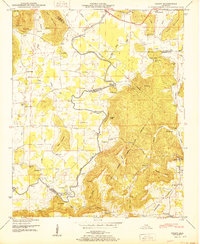
1950 Map of Grant
USGS Topo · Published 1950About this map
Paint Rock River winds through this 1940s landscape, serving as a boundary between Jackson, Madison, and Marshall counties. The era is defined by a network of river crossings and mountain-side communities, where essential fords like Helium Ford and Maple Ford provided vital transit before modern bridging. The agrarian character of the region is evident in the numerous family-named landmarks and institutions, such as Butler Mill and the D A R Sch at Grant. Steep topographic features like Keel Mountain and Gunters Mountain hem in the valley settlements, creating distinct pockets of development. Genealogists will find a wealth of specific data points, from the Kennamer Cem and Ashburn Cem to small congregations at Hill Chapel and Center Ch. The presence of oxbow features like Big Horseshoe Pond and Little Horseshoe Pond illustrates the shifting nature of the river's path over time.
Find a feature on this map
81 named features on this map. Tap any name to fly to it.
Don’t see what you’re looking for? This feature index may not catch every label — zoom into the map to look around manually.
Map Details
Editions of this 1950 Grant Map
2 editions found
Other maps of this area

1885 · Gadsden
USGS Topo · 1:125,000

1888 · Gadsden
USGS Topo · 1:125,000

1888 · Scottsboro
USGS Topo · 1:125,000

1892 · Scottsboro
USGS Topo · 1:125,000

1892 · Gadsden
USGS Topo · 1:125,000

1895 · Gadsden
USGS Topo · 1:125,000

1903 · Gadsden
USGS Topo · 1:125,000

1936 · Columbus City
USGS Topo · 1:24,000

1936 · New Hope
USGS Topo · 1:24,000

1936 · Guntersville Dam
USGS Topo · 1:24,000