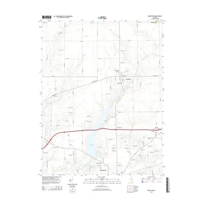
2015 Map of Grantfork
USGS Topo · Published 2015About this map
The village of Grantfork and the northern reaches of Highland anchor this Madison County landscape, where the prairie is defined by the winding course of East Fork Silver Creek and Highland Silver Lake. This modern survey reveals a dense network of family and community history, preserving the locations of numerous burial grounds such as Mundis Cem, Holtzgang Cem, and the Grantfork United Church of Christ Cem.
Find a feature on this map
93 named features on this map. Tap any name to fly to it.
Don’t see what you’re looking for? This feature index may not catch every label — zoom into the map to look around manually.
Map Details
Editions of this 2015 Grantfork Map
This is the sole edition of this map. No revisions or reprints were ever made.
Other maps of this area

1906 · Breese
USGS Topo · 1:62,500

1907 · Breese
USGS Topo · 1:62,500

1907 · Belleville
USGS Topo · 1:62,500

1927 · Edwardsville
USGS Topo · 1:62,500

1932 · Edwardsville
USGS Topo · 1:62,500

1937 · New Douglas
USGS Topo · 1:48,000

1944 · New Douglas
USGS Topo · 1:62,500

1949 · St. Jacob
USGS Topo · 1:24,000
1954 · Marine
USGS Topo · 1:24,000

1954 · Worden
USGS Topo · 1:24,000