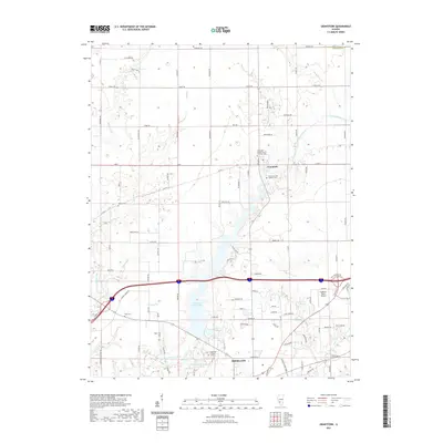
2021 Map of Grantfork
USGS Topo · Published 2021About this map
Highland serves as the southern anchor of this Madison County landscape, dominated by the expansive Highland Silver Lake and the Old City Reservoir. The village of Grantfork lies to the north, established at the junction of Co Rd 6 and Poplar St. The map highlights a deeply rooted community structure, evidenced by numerous burial grounds including the Grantfork United Church of Christ Cem and Saint Gertrude Catholic Cem. The drainage of East Fork Silver Creek and its tributaries like Sand Cr and Sugar Fork shape the terrain between these two population centers. Modern infrastructure is represented by the Highland-Winet Airport and the network of rural routes such as Alhambra Rd and Niggli Rd that connect the family farmsteads characterizing this agricultural region.
Find a feature on this map
92 named features on this map. Tap any name to fly to it.
Don’t see what you’re looking for? This feature index may not catch every label — zoom into the map to look around manually.
Map Details
Editions of this 2021 Grantfork Map
This is the sole edition of this map. No revisions or reprints were ever made.
Other maps of this area

1906 · Breese
USGS Topo · 1:62,500

1907 · Breese
USGS Topo · 1:62,500

1907 · Belleville
USGS Topo · 1:62,500

1927 · Edwardsville
USGS Topo · 1:62,500

1932 · Edwardsville
USGS Topo · 1:62,500

1937 · New Douglas
USGS Topo · 1:48,000

1944 · New Douglas
USGS Topo · 1:62,500

1949 · St. Jacob
USGS Topo · 1:24,000
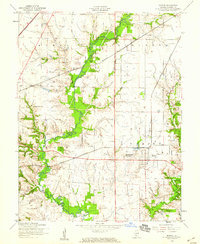
1954 · Marine
USGS Topo · 1:24,000

1954 · Worden
USGS Topo · 1:24,000