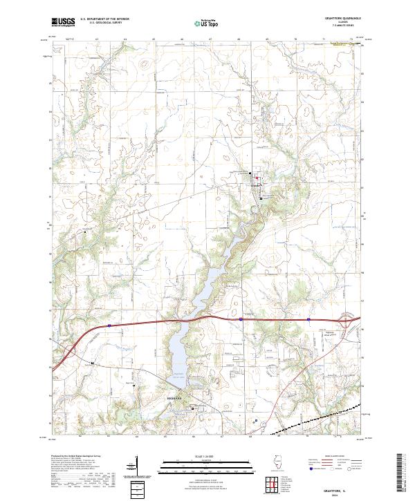
2024 Map of Grantfork
USGS Topo · Published 2024About this map
The community of Grantfork serves as a central hub in this Madison County landscape, where agriculture and modern infrastructure meet. The village is anchored by local institutions including the Grantfork United Church of Christ and Saint Gertrude Catholic Church, both of which maintain associated cemeteries that are essential for genealogical research. To the south, the city of Highland borders the expansive Highland Silver Lake, a significant water feature fed by East Fork Silver Creek. The presence of the Old City Reservoir and Highland Sportsmans Club Lake reflects a history of local water management and recreation. Family history is well-preserved across the township in smaller burial sites such as Mundis Cem, Deck Cem, and the Highland Family Cem. Outside the residential centers, the Highland-Winet Airport provides a modern transportation link, while numerous creeks like Sugar Fork and Sand Creek continue to define the drainage patterns of the rural countryside.
Find a feature on this map
102 named features on this map. Tap any name to fly to it.
Don’t see what you’re looking for? This feature index may not catch every label — zoom into the map to look around manually.
Map Details
Editions of this 2024 Grantfork Map
This is the sole edition of this map. No revisions or reprints were ever made.
Other maps of this area

1906 · Breese
USGS Topo · 1:62,500

1907 · Breese
USGS Topo · 1:62,500

1907 · Belleville
USGS Topo · 1:62,500

1927 · Edwardsville
USGS Topo · 1:62,500

1932 · Edwardsville
USGS Topo · 1:62,500

1937 · New Douglas
USGS Topo · 1:48,000

1944 · New Douglas
USGS Topo · 1:62,500

1949 · St. Jacob
USGS Topo · 1:24,000
1954 · Marine
USGS Topo · 1:24,000

1954 · Worden
USGS Topo · 1:24,000