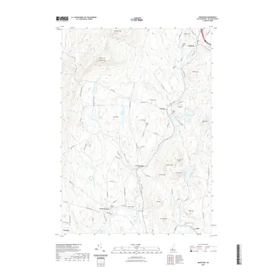
2021 Map of Grantham
USGS Topo · Published 2021About this map
The North Branch Sugar River and Sawyer Brook define the topography of Sullivan County in this 2021 study, where the highland peaks of Croydon Mtn and Grantham Mtn overlook a network of valley settlements. This modern record details the persistence of historic village centers like Croydon, Croydon Flat, and North Newport, along with the small industrial hamlet of Guild on the southern edge. The landscape is characterized by its numerous small water bodies, including Spectacle Pond, Red Leaf Pond, and Lake Coniston. Significant landmarks such as Parlin Field and the Corbin Bridge serve as focal points for local infrastructure. For the family historian, the map identifies several rural burying grounds, including Dunbar Hill Cem, East Village Cem, and the Pinegrove Cem near the Sugar River.
Find a feature on this map
102 named features on this map. Tap any name to fly to it.
Don’t see what you’re looking for? This feature index may not catch every label — zoom into the map to look around manually.
Map Details
Editions of this 2021 Grantham Map
This is the sole edition of this map. No revisions or reprints were ever made.
Other maps of this area

1902 · Sunapee
USGS Topo · 1:62,500

1905 · Sunapee
USGS Topo · 1:62,500

1906 · Hanover
USGS Topo · 1:62,500

1907 · Sunapee
USGS Topo · 1:62,500

1908 · Hanover
USGS Topo · 1:62,500

1926 · Claremont
USGS Topo · 1:62,500

1927 · Mascoma
USGS Topo · 1:62,500

1929 · Claremont
USGS Topo · 1:62,500

1932 · Mascoma
USGS Topo · 1:62,500

1950 · Glens Falls
USGS Topo · 1:250,000