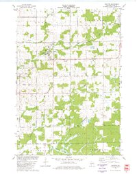
1979 Map of Granton
USGS Topo · Published 1980About this map
Granton and the surrounding township of Grant appear here in the late 1970s, defined by a landscape of small dairy farms and a network of creeks. The Chicago and North Western railroad cuts across the northern half of the sheet, passing through the village and near local landmarks like the High Sch and Park. The rural character is underscored by the high density of family and community burial grounds, including Windfall Cem, Yolo Cem, and the Pine Circle Cem.
Find a feature on this map
35 named features on this map. Tap any name to fly to it.
Don’t see what you’re looking for? This feature index may not catch every label — zoom into the map to look around manually.
Map Details
Editions of this 1979 Granton Map
This is the sole edition of this map. No revisions or reprints were ever made.
Other maps of this area

1953 · Neillsville
USGS Topo · 1:62,500

1953 · Eau Claire
USGS Topo · 1:250,000

1954 · Granton
USGS Topo · 1:62,500

1957 · City Point
USGS Topo · 1:48,000

1958 · Eau Claire
USGS Topo · 1:250,000

1958 · Hatfield
USGS Topo · 1:48,000

1964 · Eau Claire
USGS Topo · 1:250,000

1970 · City Point NE
USGS Topo · 1:24,000
1970 · City Point NW
USGS Topo · 1:24,000
1970 · Hatfield NE
USGS Topo · 1:24,000