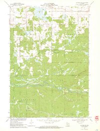
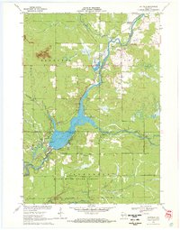
1970 Map of Hatfield NE
USGS Topo · Published 1972About this map
Shortville stands as the primary community in this rural landscape of the early 1970s, where the terrain is defined by the winding course of the East Fork Black River. The map reveals a land heavily influenced by its water systems and topography, including the drainage of Rock Creek and several large marshy basins that dominate the northern sections. This period in central Wisconsin history reflects a quiet transition, where timberlands and small farming settlements like Shortville remained connected by a modest network of section roads and highway routes. The intricate contour lines and drainage patterns provide an essential record of the natural hydrology before modern land use changes or development altered the wetland margins.
Find a feature on this map
3 named features on this map. Tap any name to fly to it.
Don’t see what you’re looking for? This feature index may not catch every label — zoom into the map to look around manually.
Map Details
Editions of this 1970 Hatfield NE Map
3 editions found
Other maps of this area

1953 · Neillsville
USGS Topo · 1:62,500

1953 · Eau Claire
USGS Topo · 1:250,000

1954 · Granton
USGS Topo · 1:62,500

1957 · City Point
USGS Topo · 1:48,000

1958 · Eau Claire
USGS Topo · 1:250,000

1958 · Hatfield
USGS Topo · 1:48,000

1964 · Eau Claire
USGS Topo · 1:250,000
1970 · Hatfield SW
USGS Topo · 1:24,000

1970 · Spaulding
USGS Topo · 1:24,000
1970 · Hatfield
USGS Topo · 1:24,000